Drone data, digital twins, trusted reality
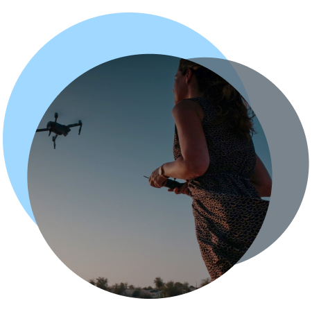
From drone photos to decision-grade 2D and 3D outputs
From photos to decision-grade outputs:
See how verification, previews, and final exports work in practice.

Verified 3D and 2D models for drone data
DT 360
UPLOAD → TRUSTRANK & PREVIEW → MODELLING → EXPORT
How the verification workflow works:
- Validate drone imagery through the TrustRank validation layer against trusted Copernicus and EUSPA reference data.
- Generate a TrustRank Decision-Grade Security report with a clear usage verdict.
- Preview coverage early in the cloud to catch gaps and issues before processing.
- Proceed only when ready and export full-resolution models for direct use in GIS and CAD workflows.
Upload a small, non-production sample to see how integrity checks & review work.
No payment details. No commitment. Learning center included.


The Technology
Aviotix DT360
Decision-grade digital twins with integrated TrustRank Validator
From photos to decision grade outputs
Use the Imagery to generate TrustRank-validated 2D and 3D digital twins:
Decision-grade validation via TrustRank.
Where appropriate, controlled AI-assisted processing is applied to accelerate reconstruction.
Its cloud-optimised preview pipeline identifies integrity and significantly reducing rework and accelerating modelling.
Additionally, the platform supports a wide range of export formats, including OBJ, FBX, GLTF, and MP4, ensuring smooth interoperability across GIS, CAD, BIM, and advanced visualisation ecosystems.
Combined with high-performance GPU acceleration and AI-enhanced photogrammetry, DT360 ensures precision, consistency, and real-world reliability.
No payment details. No commitment.
Why Aviotix
Engineering-led. Infrastructure-first.
Aviotix is built around deep technical leadership and disciplined engineering execution, focused on delivering verified, decision-grade 2D and 3D outputs for risk-sensitive use cases.
Our teams combine senior IT and applied AI expertise with rigorous validation, security, and compliance controls.
This approach is supported by AATIC – Autonomous Automatic Trustworthy Intelligent Cloud, an Aviotix-owned private cloud infrastructure designed for controlled execution and long-term operational stability.

Technology Ecosystem
Built using European Earth observation
and satellite navigation data

Uses data from the Copernicus Programme of the European Union and GNSS (HAS) signals from Galileo.
Investors and Partners
Collaborations supporting long-term value
Industries We Serve
Case studies across sectors
From photos to decision-grade outputs - DT360 supports professional use cases across surveying, construction, urban planning, insurance, and cultural heritage.
As a result, the platform delivers TrustRank-validated 2D and 3D outputs that support planning, documentation, and decision-making, whether in the field, in the office, or within cloud-based workflows.
Ultimately, Aviotix works with customers, partners, and investors who value data integrity, technical rigor, and long-term trust.
INSURANCE
Document assets and assess claims using validated, measurable 2D and 3D models powered by TrustRank.
Independent Validation
Independent customer feedback and third-party reviews are available on G2 and Trustpilot, reflecting production use of DT360 across regulated and professional environments.

Security & compliance
Security first — privacy by design
Aviotix ensures full encryption of all data transfers, with the option to host on EU-based or global data centres. Security and integrity are therefore built into every step, helping you meet compliance requirements with confidence.
Community & Ecosystem
Shaping the future of spatial computing
We support innovation, join key events, and advance awareness around spatial computing and AI modelling — toward a living, digital index of the real world.

Turn drone images into actions
Upload your dataset to run integrity validation and controlled 3D processing with auditable results.
Processing is executed in a controlled, GPU-powered cloud environment (AATIC) designed for enterprise workloads.
Start with a small non-production sample to review integrity checks and workflows.
No payment details. No commitment. Learning center included.
Stay in the loop with updates
Contact
- For general inquiries:
- For quotes:
- Join the forum: