DRONE TWINS 360
Decision-grade models from imagery
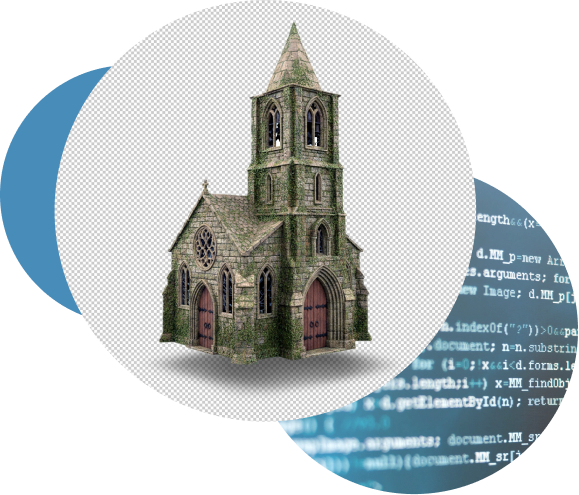
2D and 3D modelling becomes straightforward with DroneTwins360 Digital Twins. In just a few steps, teams can generate decision-grade models ready for digital twin workflows from imagery, including drone captures as well as standard camera or smartphone photos.
As a result, reliable, high-quality outputs are produced without complex workflows.
First, upload a small, non-production sample to see how integrity checks and review work.
Additionally, no payment details are required, there is no commitment, and the learning center is included.


DroneTwins360
Aviotix offers DroneTwins360
Above all, Aviotix applies TrustRank Integrity check before any 3D reconstruction begins. Drone imagery is validated against trusted ESA and EUSPA reference datasets, including Copernicus, Sentinel-2, and Galileo HAS.
This ensures that manipulated imagery, AI-generated content, altered metadata, or manually tampered datasets to be identified and excluded before they enter the processing pipeline.
After validation, DroneTwins360 provides fast previews, supports exports in PLY, TIF (Orthomosaic), OBJ, FBX, glTF, and MP4 formats, and offers a dedicated Gaussian Splatting workflow.
Additionally, we believe the future of spatial understanding lies in automation, speed, and accessibility.
As a result, the platform is built for decision-grade 2D and 3D reconstruction from imagery captured by drones, cameras, and smartphones, optimised for scalability and precision.
Consequently, users can firstly assess image quality and coverage before launching full-resolution processing.
Additionally, no payment details are required, there is no commitment, and the learning center is included.
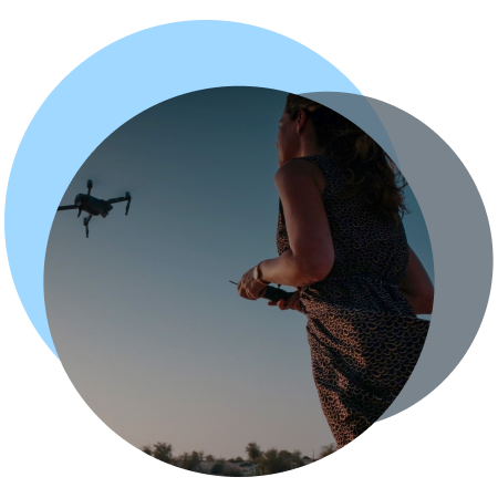
Introducing the Aviotix solution for drone pilots.


Cloud Previews
Assess coverage and quality before processing

Rich Outputs
Export seamlessly to formats like PLY, FBX, OBJ, GLTF, MP4

Open Architecture
Modular design and open API

Pipeline‑Ready
Plug into GIS, CAD and VFX tools
Drone Twins 360 Tutorial
Take a quick look at how it works
Why DroneTwins360
Built for speed, accuracy and scale
From individual structures to full urban environments, DroneTwins360 scales efficiently without compromising speed or detail. In addition, cloud-based previews help teams catch issues early, before committing to full processing.
As can be seen, high-resolution models are delivered in industry formats such as TIF (Orthomosaic), OBJ, FBX, glTF, MP4.
Moreover, with GPU acceleration and AI-driven photogrammetry at its core, DroneTwins360 delivers consistently reliable, production-grade quality across every project.)
Additionally, no payment details are required, there is no commitment, and the learning center is included.
Ground control point Integration
Digital twins anchored in reality
Our latest update introduces full GCP (Ground Control Point) integration, enabling accordingly every orthomosaic and 3D reconstruction to align precisely with real-world coordinates.
Finally, your models are no longer just virtual — they’re geospatially accurate, measurable, and ready for smart-city, construction, and infrastructure workflows.
Moreover, at Aviotix we believe that digital twins begin with trust: above all, verified data, precise alignment, after that transparent processing.
With this in mind, DroneTwins360 ensures after all that every dataset you capture can evolve into a true digital twin anchored in reality.
First, upload a small, non-production sample to see how integrity checks and review work.
Additionally, no payment details are required, there is no commitment, and the learning center is included.

How It Works
From drone to digital twin in four steps

UPLOAD → TRUSTRANK & PREVIEW → MODELLING → EXPORT
A streamlined, secure pipeline that scales from single buildings to cityscapes.
1
Upload
First, secure and scalable imagery ingestion to the cloud.
2
TRUSTRANK and PREVIEW
Then, TrustRank validation and early preview.
3
Modelling
Next, GPU-accelerated high-resolution, multi-format reconstruction.
4
Export
Finally, export to digital twin workflows, GIS, or CAD in standard formats.
Upload a small, non-production sample to see how integrity checks & review work.
No payment details. No commitment.

Formats & Use Cases
Export anywhere — share everywhere
From single assets to complex city-scale environments, DroneTwins360 scales seamlessly while maintaining speed and precision.
In addition, cloud-based previews allow teams to detect issues early before full processing begins.
As a result, high-fidelity outputs are delivered consistently in OBJ, FBX, glTF, MP4, and other industry formats.
Moreover, GPU acceleration combined with AI-enhanced photogrammetry ensures reliable performance and professional-grade quality across every project.
Industries We Serve
Case studies across sectors
From photos to decision-grade outputs - DroneTwins360 supports professional use cases across surveying, construction, urban planning, insurance, and cultural heritage.
As a result, the platform delivers TrustRank-validated 2D and 3D outputs that support planning, documentation, and decision-making, whether in the field, in the office, or within cloud-based workflows.
Ultimately, Aviotix works with customers, partners, and investors who value data integrity, technical rigor, and long-term trust.
INSURANCE
Document assets and assess claims using validated, measurable 2D and 3D models powered by TrustRank.
Independent Validation
Independent customer feedback and third-party reviews are available on G2 and Trustpilot, reflecting production use of DroneTwins360 across regulated and professional environments.
Testimonials
What our clients say about Drone Twins 360
Independent customer feedback and third-party reviews are available on G2 and Trustpilot, reflecting production use of DroneTwins360 across regulated and professional environments.
Pricing
Transparent pricing for every team
From free trials to enterprise deployments with SLAs and API access — simple plans, predictable costs, no surprises.
DroneTwins360 FAQ
Your questions about
DroneTwins360, answered
What is DT360?
DT360 is a cloud tool that turns your drone, camera, or phone photos into clean, accurate 3D models. Beyond that, it includes built-in data integrity checks and deepfake detection & reporting.
Furthermore, the Learning Centre explains exactly how to apply these tools effectively.
Do I need any experience to start?
No — DT360 is built for everyone. Even so, the Learning Centre offers clear, beginner-friendly guides for uploads, processing, and authenticity verification.
In turn, this helps you progress confidently from the very first dataset.
How fast can I create my first model?
You can upload and preview your dataset within 20 minutes or faster, depending on the number of images in your dataset.
From there, the Learning Centre guides you step-by-step from basic uploads to full 3D outputs, including integrity-validated datasets.
In fact, many users complete their first full workflow within a couple of hours.
Why should I subscribe in DT360?
The subscription unlocks the DT360 Learning Centre. In turn, you gain access to tutorials, tips, best practices, and guidance on data integrity and deepfake detection & reporting.
Additionally, you receive limited trial access to explore DT360 — including the 3D preview and the Photo Integrity Check & Deepfake Detection workflow on your own dataset.
The trial dataset remains available until you decide to delete it, in line with our GDPR-compliant retention policy.
Meanwhile, you’re free to experiment with your own dataset.
Sign-up required. No payment details. No commitment.
Turn drone images into actions
Upload your dataset to run integrity validation and controlled 3D processing with auditable results.
Processing is executed in a controlled, GPU-powered cloud environment (AATIC) designed for enterprise workloads.
Start with a small non-production sample to review integrity checks and workflows.
No payment details. No commitment. Learning center included.
Stay in the loop with updates
Contact
- For general inquiries:
- For quotes:
- Join the forum: