Representative case study
Insurance
An anonymised example illustrating how DT360 is used for insurance documentation and claim assessment.

Context
Insurance workflows require objective, verifiable documentation of assets and incidents.
Measurable 2D and 3D data supports accurate assessment, internal review, and audit readiness while reducing ambiguity in claim evaluation.
Dataset integrity and consistency were validated using the TrustRank validator prior to processing.
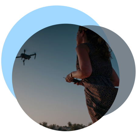
Input Data
- Drone imagery of insured assets
- Small to medium-area coverage
(single property or bounded asset area) - Residential or commercial environment
- Accuracy and auditability requirements
DT360 Workflow
- Upload of drone imagery
- Automated dataset integrity validation using the TrustRank Checker
- 2D and 3D processing
- Review and export for reporting
3D model characteristics:
- Model type: Photogrammetric mesh
- Vertex count: ~8–15 million
- Texture resolution: up to 4K–8K (tiled)
- Export formats: PLY
Delivered Outputs
- Measurable, geo-referenced orthomosaic
- TrustRank-validated 3D asset model
- Datasets suitable for reporting, internal review, escalation, and downstream assessment
Typical processing time
- End-to-end turnaround: ~1.5–3 hours per dataset
How the outputs were used
- Baseline asset documentation prior to or following an incident
- Claim assessment using measurable, integrity-validated spatial evidence
- Provision of verifiable datasets for internal review, dispute handling, or audit
Observed operational impact
- Time to usable documentation:
reduced from 1–2 days to same-day delivery - Reduced ambiguity in claim review:
consistent spatial reference replaces manual photo interpretation - Improved audit readiness:
all outputs traceable to a TrustRank-validated dataset
Note:
Project details have been anonymised.
Downloadable models from this project cannot be shared due to confidentiality obligations.
All workflows, metrics, and outputs shown are representative of typical DT360 production use in insurance documentation and claim assessment contexts.
Industries We Serve
Case studies across sectors
From photos to decision-grade outputs - DT360 supports professional use cases across surveying, construction, urban planning, insurance, and cultural heritage.
As a result, the platform delivers TrustRank-validated 2D and 3D outputs that support planning, documentation, and decision-making, whether in the field, in the office, or within cloud-based workflows.
Ultimately, Aviotix works with customers, partners, and investors who value data integrity, technical rigor, and long-term trust.
INSURANCE
Document assets and assess claims using validated, measurable 2D and 3D models powered by TrustRank.
Independent Validation
Independent customer feedback and third-party reviews are available on G2 and Trustpilot, reflecting production use of DT360 across regulated and professional environments.
Turn drone images into actions
Upload your dataset to run integrity validation and controlled 3D processing with auditable results.
Processing is executed in a controlled, GPU-powered cloud environment (AATIC) designed for enterprise workloads.
Start with a small non-production sample to review integrity checks and workflows.
No payment details. No commitment. Learning center included.
Stay in the loop with updates
Contact
- For general inquiries:
- For quotes:
- Join the forum: