Representative case study
Education
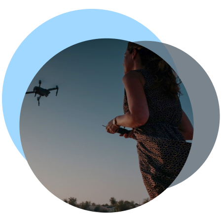
An anonymised example illustrating how DroneTwins360 supports professional drone training and education.

Context
Professional drone training requires fast feedback, objective evaluation of datasets, and clear visualisation of how pilot decisions affect final outputs.
Both trainees and instructors need immediate insight into dataset quality in order to shorten learning cycles, understand the impact of capture choices, and avoid repeating costly mistakes.
Input Data
- Drone imagery captured by trainee pilots
- Small to medium-area training missions
- Mixed-quality datasets (correct and incorrect capture practices)
- Educational and assessment-focused constraints
Representative training dataset parameters
- Surveyed area: ~0.02–0.04 km²
- Image set: ~80–200 drone images
- Flight altitude: 30–70 m AGL
- Ground Sampling Distance (GSD): ~1.2–2.5 cm/pixel
DroneTwins360 Workflow
- Immediate upload of training flight imagery
- Automated dataset consistency analysis using the TrustRank Integrity Engine
- Fast preview of reconstruction and dataset consistency
- Visual identification of weak or problematic areas in the dataset
(coverage gaps, overlap, geometry instability)
Typical turnaround time
- Initial feedback available: within 10 minutes
- Preview-ready outputs: <1 hour after upload
- 2D orthomosaic with GCP data generated: <3 hours
Delivered Outputs
- Rapid visual preview of dataset quality
- Clear indicators of coverage gaps, overlap issues, and capture errors
- Comparable previews from correct vs. incorrect capture workflows
- Training-grade 2D orthomosaic (GeoTIFF)
- Geo-referenced
- Includes Ground Control Point (GCP) data
- Suitable for independent inspection in QGIS
How the outputs were used
- Trainee pilots quickly identified weaknesses in their datasets, reducing trial-and-error rework
- Instructors visually demonstrated the consequences of correct and incorrect flight and capture decisions
- Training sessions became shorter, more objective, and easier to assess
Observed training outcomes
- Learning cycles shortened by ~40–60%, enabling faster progression from capture to usable outputs
- Fewer repeat flights required due to early identification of capture errors and dataset weaknesses
- Assessment and exam performance improved by ~20%, reflecting clearer feedback loops and objective, data-driven evaluation criteria
GCP Training & Sample Output (Independent Inspection)
As part of the education workflow, DroneTwins360 is used to teach and demonstrate correct Ground Control Point (GCP) usage in drone dataset modelling.
Trainees learn how GCP placement affects scale, alignment, and spatial stability, and how GCP-referenced outputs can be independently verified in standard GIS tools.
To support hands-on learning and external inspection, we provide downloadable, representative 2D and 3D sample outputs generated through DroneTwins360:
2D Sample (Orthomosaic)
- Geo-referenced orthomosaic (GeoTIFF)
- Suitable for inspection in QGIS or equivalent GIS software
- Includes Ground Control Point (GCP) data for spatial reference and independent verification
3D Sample (Mesh Model)
- Lightweight photogrammetric 3D model
- Exported for standard 3D viewers (PLY compatible)
- GCP-referenced geometry enabling scale and alignment inspection
Note:
Project details have been anonymised.
The described workflow, quantitative metrics, and outputs are representative of typical DroneTwins360 production use in professional drone training and education environments and do not correspond to a single identifiable project.
Industries We Serve
Case studies across sectors
From photos to decision-grade outputs - DroneTwins360 supports professional use cases across surveying, construction, urban planning, insurance, and cultural heritage.
As a result, the platform delivers TrustRank-validated 2D and 3D outputs that support planning, documentation, and decision-making, whether in the field, in the office, or within cloud-based workflows.
Ultimately, Aviotix works with customers, partners, and investors who value data integrity, technical rigor, and long-term trust.
INSURANCE
Document assets and assess claims using validated, measurable 2D and 3D models powered by TrustRank.
Independent Validation
Independent customer feedback and third-party reviews are available on G2 and Trustpilot, reflecting production use of DroneTwins360 across regulated and professional environments.
Turn drone images into actions
Upload your dataset to run integrity validation and controlled 3D processing with auditable results.
Processing is executed in a controlled, GPU-powered cloud environment (AATIC) designed for enterprise workloads.
Start with a small non-production sample to review integrity checks and workflows.
No payment details. No commitment. Learning center included.
Stay in the loop with updates
Contact
- For general inquiries:
- For quotes:
- Join the forum: